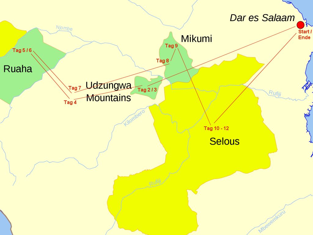
14 Days Tanzania Southern Circuit Safari
brief overview
This Tanzania tour starts in the coastal metropolis of Dar es Salaam and takes you to the little known national parks and protected areas of the Southern Circuit. During this trip you will visit little frequented parks and due to the vastness of the areas you will rarely see other travellers.
First you will drive from Dar es Salaam to the Udzungwa Mountains National Park. In this tropical mountain rainforest an armed ranger will accompany you to spectacular mountain landscapes and remote waterfalls. Afterwards you will visit the city of Iringa, founded by German colonialists. From there the safari continues to Ruaha National Park, named after the Great Ruaha River. This river allows a variety of animals and plants even in the dry months. Next on the program is the Mikumi National Park with the most big game species in Tanzania. Last but not least you will visit the Selous Game Reserve, a huge protected area with more than 50.000 km² – bigger than Switzerland.
Day 1: Arrival Dar es Salaam
Transfer from Julius Nyerere International Airport or harbour (e.g. Ferry from Zanzibar) to your accommodation.
Day 2: Dar es Salaam – Udzungwa Mountains National Park
Your first stop is Udzungwa Mountains National Park, which you reach after a 4 to 5 hour drive. The trail leads on a well tarred road past Morogoro and the Uluguru Mountains. The Morogoro region with its surrounding mountain ranges is one of the most fertile areas of Tanzania and supplies Dar es Salaam and other coastal regions with agricultural products. Soon after, the road signs remind you that you are crossing the Mikumi National Park. The Tanzania – Zambia Highway, which crosses the Mikumi National Park, is the main link between Dar es Salaam and the south of the country.
The Udzungwa National Park was declared a protected area in 1992 with the support of the World Wildlife Fund. It was opened by Prince Bernhard of the Netherlands as a co-founder of the WWF. This mountainous region covers an area of approximately 2,000 square kilometres, with mountain forests extending between 300 and 2,800 metres in altitude. The Udzungwas are an important watershed and the water resources there irrigate the fertile Kilombero Valley. As a result of the different altitudes there are four vegetation zones: flat forest, submontane mountain forest, low mountain forest and high mountain forest. After a varied drive you will reach your accommodation near the National Park Headquarters.
Day 3: Udzungwa Mountains National Park
After breakfast you will go with an armed ranger to the Sanje waterfalls; a hike of about 10 kilometers in total, which starts in the village of Sanje. The houses in Sanje have on average the size of a comfortable German bathroom (about 3 x 3 meters), are built of pressed soil bricks and covered with corrugated iron. The furnishings usually consist of a bed and a small table, there is no electricity to think of. Cooking is done with firewood outside the hut. The villagers are allowed to take fallen trees, fallen branches etc. from the area around the park twice a week.
Their hike leads on steep paths higher and higher into the mountainous landscape, which is densely forested, unlike most other regions in East Africa. If it was hot, you would start to sweat, but often it is cloudy and the trees provide pleasant shade. On fertile, sunlit clearings, where mushrooms, lichens, mosses and ferns colonise every moist bark of the jungle trees, where the wonderful smell of the forest takes up all senses, one really thinks of a fairy tale forest. After about two or three hours you reach the ponds at the foot of the Sanje waterfalls. The view of the falling water masses is simply fantastic. In total there are three water cascades, the biggest of which is the actual Sanje waterfall, which gushes out from a height of 200 metres. Bathing is a must here – don’t forget your bathing equipment. In the afternoon you make your way back. In Sanje your driver will be waiting for you to take you to your accommodation.
Day 4: Udzungwa Mountains National Park – Iringa Town
Today you will leave the Udzungwa Mountains and drive on to Iringa, the town closest to Ruaha National Park. Soon the road begins to rise and takes a winding route through quite mountainous terrain, the Rubeho Mountains. Here the settlement areas of the Hehe overlap with those of Luguru. Typical are the single farmsteads that appear from time to time, real villages do not exist here in this area. People and their cattle seem to come from nowhere. Soon the settlement decreases completely and there is only dense primeval and bush forest.
You now pass the place where the Great and the Small Ruaha River meet. The river becomes wider and flows more calmly. The settlement is increasing again, the locals are building the land, because the valley is well supplied with water.
Before Iringa you will pass by the impressive Kitonga mountains. After Kitonga the road begins to rise serpentine up to the last step of the high plateau of Iringa. The picturesque town with its blue Jacaranda avenues has about 150,000 inhabitants and is situated at an altitude of 1,600 meters, so warm days and cool nights. Due to its location on the rocky plateau you have a beautiful view of the surroundings of the city, especially of the many tobacco and corn fields in the plain. Iringa was founded by German colonialists at the end of the 19th century. Because of its strategic location, they built a large fort in 1896 as a defensive post against the rebellious Hehe. There are still some buildings from the German colonial period to visit. The old German fort is located in the centre behind the police building. Before it was built, a memorial was erected for fallen Africans in the Maji-Maji uprising. In the surroundings there are some historical places that remind on the brutal rule of the German colonialists. After a detailed city tour you will drive to your accommodation.
Day 5: Iringa – Ruaha National Park
After breakfast the drive to Ruaha National Park can begin. The road is in an acceptable condition and so you can cover the 120 kilometres in about two hours. Once you arrive in the national park, you will stay in your accommodation for two days.
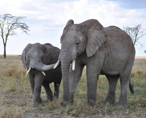
The Ruaha Park is not yet very crowded but it is one of the largest elephant sanctuaries in Tanzania. It takes its name from the Great Ruaha River, which meanders along its entire eastern boundary between colossal boulders and sandbanks and offers spectacular scenery with gorges of orange shining sandstone. The Ruaha River is the character river of Ruaha National Park, similar to the Selous of the Rufiji River. During the dry months the wildlife is concentrated along the river, so there is plenty to see and do near the river. Often the rivers dry up completely. On these so called sand rivers there are still many animals to be seen, because under the sand surface of the river there is often an impermeable rock layer, so that the water can be reached within a trench distance from the surface. The animals can therefore easily obtain the vital water. Accordingly, you can see elephants in the area of the Mwangusi and Mdonyo Sandriver as they dig water holes with their trunks and even with their clumsy feet to get to the cool water. – During the rainy season (from March to May), however, both the Ruaha National Park and the Selous Game Reserve have tributaries of the Ruaha and Rufiji Rivers, respectively, which swell into huge streams that flood the roads.
Day 6: Ruaha National Park
You will undertake various game drives and will not be bored for a second. You will always be aware of the peaceful atmosphere in this part of Africa – no other car, no masses of tourists, only the sounds of nature can be heard. Far away seems to be any civilization, the words hectic and time seem insignificant, almost unknown.
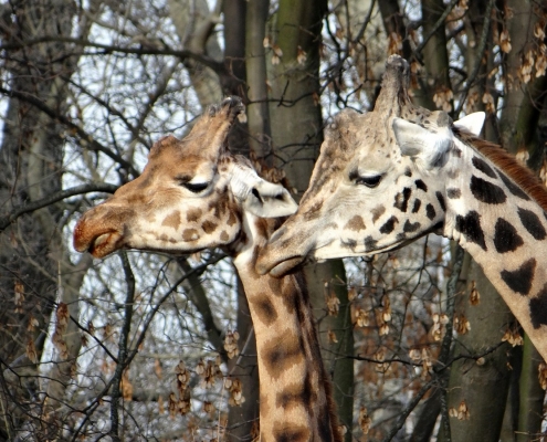
The afternoon a good time to observe the wildlife along the Ruaha River. It is the time when the game comes to water. Hippos lie lazily in the water in groups of 10 to 20 females with their young. The hippopotamus bull chases all other males out of the herd, even pubescent young bulls (7-8 years old). These then join bachelor herds or live alone. Elephants trot along the river banks, herds of buffalo have settled there; antelopes, zebras and giraffes – a constant coming and going. But there are also many Nile crocodiles and you can watch them at the riverbanks, where they sunbathe in peace and quiet. During the deerstalking journey one gets to know different habitats, which are very different: Miombo forest land and acacia groves, uneven hilly terrain, grass plains, breathtakingly beautiful granite rock formations and repeatedly dried up river beds. During the dry season the buffalo come twice a day to the remaining water holes in the riverbed. Of course lions have hidden in the bush and wait for the thirsty ones. At such a waterhole, the most likely way to observe the natural interaction between predator and prey with your own eyes is to hunt. Ruaha Park boasts the largest population of lions in East Africa. It is not uncommon to see three or four different groups in a single day. In the evening you will return to your accommodation for a “Sun Downer”.
Day 7: Ruaha National Park – Iringa Town
Before breakfast you go on early game drive, anticipating the sunrise. Lions find plenty of prey, especially near the river, and are especially good hunters at this time of the day. After the game drive is finished, breakfast is made up for.
After the car is loaded, leave Ruaha Park and drive towards Iringa. On the way there you will stop at the Isimilia site, which is just outside Iringa. It is one of the most important sites of its kind in Africa. An absolute must. During the Paleolithic Age, people lived here and left us a legacy of countless tools: hand axes, stone rakes, hammers, cleavers, spearheads, scrapers, etc. At the end of the 1950s, archaeologists from America discovered these Stone Age finds, which are between 60,000 and 100,000 years old. – During the excavation work, numerous fossilized antelope and pig bones were also found, which could be an indication of a former slaughterhouse. Among the most spectacular finds were the well-preserved skeleton pieces of a Gorgop, a forerunner of our hippopotamus, which these Stone Age people probably hunted as well. Through the narrow gorge of a side wadi we then return to Iringa and your accommodation.
Day 8: Iringa – Mikumi National Park
On the way towards Selous Game Reserve you will take a little more time to visit Mikumi National Park. From Iringa the road goes down into the valley over breathtaking serpentines. The conditions here are ideal for bamboo and of course there are enough grazing grounds. Accordingly, the area is populated. At the park entrance to the Mikumi the driver takes care of the entrance formalities and brings you to your accommodation. The Mikumi National Park is the most popular of all the southern parks, probably because it can be reached relatively quickly from Dar es Salaam. The protected area was declared a national park in 1964. However, it has only existed in its current extension since 1975. With more than 3,000 square kilometres, it is the third largest national park in Tanzania and thus larger than the country of Luxembourg. Any kind of hunting is prohibited, in contrast to the Selous, with which the Mikumi forms a common ecosystem, the largest in Africa. On three of its four sides, the Mikumi is surrounded by mountain ranges as a natural boundary. From south to west to north are the Rubeho Mountains, in the east the Uluguru Mountains. The name of the park is derived from the Swaheli: the Borassus palm tree that used to grow everywhere in the park is called Mikumi. Already Stanley, after his legendary encounter with Livingstone in Ujiji at Lake Tanganyika, crossed this area in 1872 on his way back to Dar es Salaam.
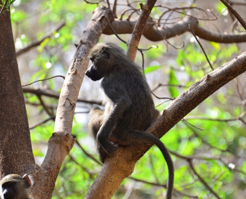
Your ‘deerstalking’ journey leads you first in north-western direction through the big savannah of the Mkata plains. The Mkata River flows from south to north through the reserve, but during the dry season it hides below the surface and makes its way underground. During the rainy season, however, it overflows its banks more often. This flood plain is preferred by the Yellow Baboons as their habitat. This species is lighter in colour and its physique is not quite as heavy as that of the Olive Baboons found in the North Parks. Baboons mainly eat grass, fruit and insects, but they also hunt and kill young impalas, reedbucks and other antelopes. After so much fresh air and adventure, you can look forward to dinner at your accommodation.
Day 9: Mikumi National Park – Morogoro Town
After breakfast at the camp, you will spend another half day exploring the Mikumi National Park. Open grasslands dominate the flood plain, which attracts game from the Miombo forest land. Interesting are the Mikumi elephants. They are much more compact than the other elephants in Tanzania, smaller and stockier. The reason for this fact has not yet been researched. Perhaps an unnatural selection has taken place due to the brisk ivory trade. The Mikumi is home to about 4000 to 6000 elephants.
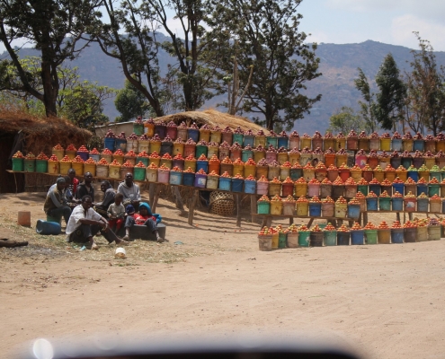
After this beautiful game drive you leave Mikumi National Park via the Kikaboga entrance gate. For the night you stay in Morogoro. Morogoro is with 130.000 inhabitants a rather small town. In the middle of the town there is a market, which is always very busy.
Day 10: Morogoro – Selous Game Reserve
From Morogoro we continue south today, on a little used all-weather track (only partly asphalted) to the Selous Game Reserve. This is the most beautiful road on your whole tour, through the northern foothills of the forested Uluguru Mountains: a red road leading through a lush green landscape. This route has some steep sections. The vegetation and scenery along the route will delight you. Agriculture on one side (especially around the villages) and lonely wilderness on the other side alternate regularly. Shortly after Morogoro the road soon begins to rise gently. About 20 kilometres from Morogoro you cross a pass of the picturesque Uluguru Mountains and drive in serpentines into the valley of Msumbisi. Dense tree growth, sometimes hair-raising curves and sparse settlements line the road. Passing Mkuyuni, we continue over the Ruvu River to Mvuha, where your driver fills up the car. The village of Kisaki is the last village before the Selous Conservation Area. In Kisaki you soon meet the TAZARA railway line and then it is really only a few kilometres to Matambwe Gate of the Selous Game Reserve. After you have completed the entry formalities, your guide will take you to your desired accommodation.
With 55,000 square kilometres the Selous is the largest game reserve in Africa. Imagine the full size of the Netherlands with half the size of Belgium or four times the Serengeti. The Selous was first opened in 1905 by the German colonial government and reopened in 1951. In 1982 the game reserve was declared a World Heritage Site by UNESCO. It is named after the big game hunter and later naturalist Frederick Selous (pronounced: Seluu). Today, luxury safaris are marketed here at horrendous prices. We keep it more modest and accommodate you as usual on a campsite, which is located just behind the park border on the Rufiji River. – Typical for the Selous are its vast landscapes with the dry Miombo forests that surround the Rufiji River. Together with its many water arms and floodplains, this river creates a unique atmosphere. Not only hippos and crocodiles, but also water birds of various species can be observed up close again. The loop between the two lakes Nzelakela and Manze is especially beautiful, but also a detour to Beho Beho and to the tomb of Selous is worthwhile.
Day 11: Selous Game Reserve
Depending on your choice of accommodation, there are various activities available: Game drives, hikes with a park ranger, boat safari on the Rufiji River, night game drives etc.
Day 12: Selous Game Reserve
Depending on your choice of accommodation, there are various activities available: Game drives, hikes with a park ranger, boat safari on the Rufiji River, night game drives etc.
Day 13: Selous Game Reserve – Dar es Salaam
With the first rays of sunshine, breakfast is on the table and your luggage and equipment are stowed in the car, then you start the long drive (approx. 6 hours, 255 km) in a northerly direction through the coastal strip at sea level to Dar es Salaam. Here you might get a glimpse of life in Tanzania once again, see the children in their colourful school uniforms. Termite mounds line the road and you can watch the Maasai and their herds as you drive by. Small villages or seemingly completely uninhabited areas rush by. For lunch you will picnic on the way. For the last 25 kilometres the road runs along the south coast of Dar es Salaam, where dense vegetation and soils with fine white sand and palm trees betray the proximity to the Indian Ocean. In the late afternoon you will return to your hotel in Dar es Salaam where you started your epic adventure Safari.
Day 14: Safari End Dar es Salaam
After breakfast transfer to Julius Nyerere International Airport or harbour (Zanzibar ferry).
Itinerary
Day 1: Arrival Dar es Salaam
Day 2: Dar – Udzungwa Mountains National Park
Day 3: Udzungwa Mountains NP
Day 4: Udzungwa Mountains NP – Iringa
Day 5: Iringa – Ruaha NP
Day 6: Ruaha NP
Day 7: Ruaha NP – Iringa
Day 8: Iringa – Mikumi NP
Day 9: Mikumi NP – Morogoro
Day 10: Morogoro – Selous Game Reserve
Day 11: Selous Game Reserve
Day 12: Selous Game Reserve
Day 13: Selous Game Reserve – Dar es Salaam
Day 14: Safari End Dar es Salaam


