Your Mountain Guides
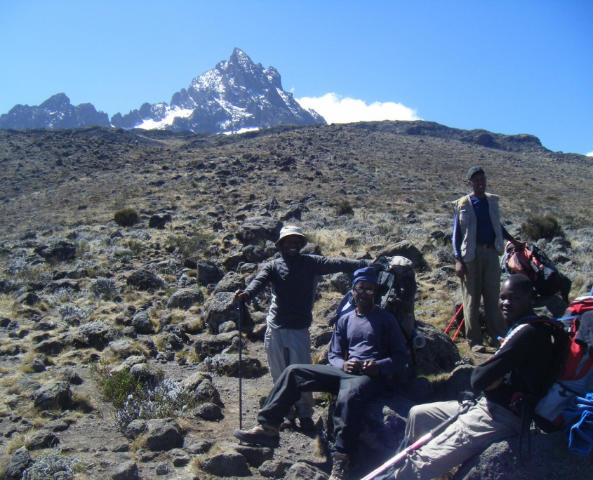
A successful ascent to Kibo Peak (highest Kilimanjaro peak) not only requires personal determination and good physical condition, it also depends on your team, especially your experienced obligatory mountain guide. Your mountain guide has climbed the summit dozens of times and knows all the routes and paths. During your Kilimanjaro tour, your mountain guide will be your mentor, he will lead you to the summit and guide you down safely. Take his advice seriously and always follow his instructions.
All our mountain tours are led by highly qualified guides registered with Kilimanjaro National Park. The guides are trained in first aid measures and receive a refresher course every year. Qualification as a Kilimanjaro guide brings with it great prestige and respect. Remember that your guide will have gained experience first as a porter and then as an assistant guide. Only then, after a successful written and physical examination, he has the opportunity to be promoted to full Kilimanjaro Guide. For a successful promotion, candidates must reach the summit on their own within 2 days. Animal and plant life is also part of their training curriculum.
Kilimanjaro Porters and Cooks
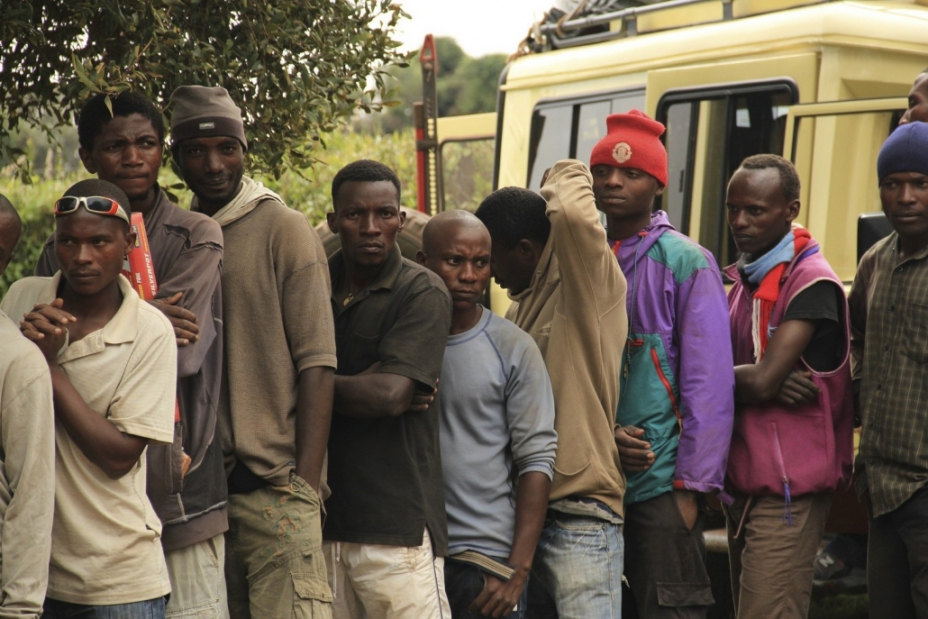
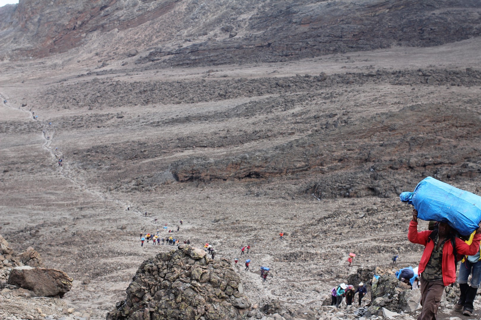
The porters not only transport all the excursion equipment (tents, gas bottles, food, cooking utensils), but also your personal luggage up and down the mountain. You will only carry your light day pack. Because all of your porters are young and fit men who have been used to marching long distances since childhood, they will reach the day’s destination long before you, despite their heavy load. When you arrive, all the equipment is already installed and hot tea (chai) is waiting for you.
Your mountain cooks will prepare delicious food with simple gas stoves and limited equipment; hearty meals with appetizers and desserts and even freshly baked bread! Please note that there is a weight limit of 20 kg per porter. A simple bag is absolutely sufficient – a backpack is not necessary, as the porters carry the loads in typical African fashion on their head and shoulders.
With every Kilimanjaro ascent, the tip is an important additional income for your team – especially for your porters. The exact amount of gratuity depends on the group size, the length of your tour and of course your personal preference. Please note: We recommend that you hand over the tip and a thank you to each crew member personally at the end of your trek. We follow the guidelines of the the Kilimanjaro Porters Association.
Physical Requirements
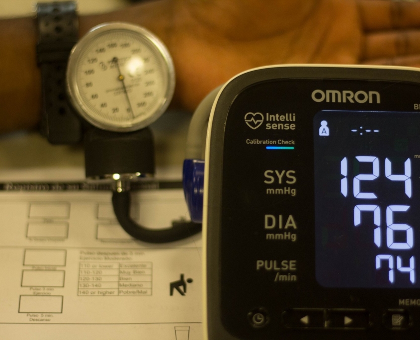
The minimum age for climbing Kilimanjaro is 10 years. Although there is no maximum age, it is important to remember that this is a physically demanding hike. Hikers with 60 years+ should consult with their doctors first. Your resting heart rate should be below 100 beats per minute to attempt the ascent. If it is higher, you should get a doctor’s permission before attempting the ascent.
All prospective Kilimanjaro aspirants should undergo a medical examination before attempting the ascent. Ask your doctor specifically about mountaineering at high altitudes in relation to your age, fitness level and general health. Also ask if any of your pre-existing conditions (especially spinal problems, circulatory problems, diabetes, intestinal or kidney problems, asthma, high or low blood pressure, and heart disease) could possibly cause issues and if certain medications could affect your acclimatization and performance. Ask if it is possible to take Diamox with one of your current medications. This is a popular medication to prevent altitude sickness. All this should be clarified before you start your adventure.
Personal Fitness
A lot of other tour operators will recommend you complicated training plans according to their Kilimanjaro Travel Guide. We think everyone has to find their own way. In our opinion, the best way to prepare for Kilimanjaro is daily exercise and sports, ideally at high altitudes. Hike as much as possible on hills or mountains to train your cardiovascular system and your leg muscles. If you do not have access to outdoor trails, you can simulate the physical demands of mountaineering in the gym. The choice of the right route should be based on a realistic self-assessment. The body can get used to the extreme altitude to a certain extent within a few days by producing more red blood cells. This adaptation is called acclimatization. With each additional day on the mountain, the chances of a successful summit ascent increase.
Training
Training should be started at least three months before the ascent. However this depends very much on your personal condition. If you have not yet gained much mountain experience, it is best to start your training at a slow pace with shorter time intervals and minimal weight in your backpack. As your fitness improves, you can gradually increase your training program. It is important to remember that when climbing Kilimanjaro, you will be walking at a slow pace for a long time and will rarely carry more than 10 kilos. It is not a race, and training should reflect this. Proper breathing while hiking should be a habit from the very start.
Gradually increase the length of your exercises and the weight in your backpack instead of worrying about the pace. You should try to train for at least one hour, three days a week. If you can complete day hikes of 4 to 6 hours with moderate altitude differences and 10 kg in your backpack without any problems and pain, you are probably ready for your adventure. You should do your longest and hardest training sessions during the last four weeks before your departure and then reduce the training just before your ascent. Your body needs time to rest and gather energy. You can also supplement your hiking training with swimming, cycling or jogging to improve your endurance and condition. Don’t forget to test and break in your hiking boots and rucksack during your training to avoid unpleasant surprises with blisters on Kilimanjaro. Physical training is an important part of climbing, but not the only one. Your daily lifestyle in terms of alcohol consumption, work stress and sleep are also very relevant.
Altitude sickness
Altitude sickness (or mountain sickness) is a condition caused by an accelerated ascent that does not give the body time to adapt to the reduced oxygen content and changes in air pressure. This leads to hypoxia, a lack of oxygen in the blood and tissues. The symptoms usually appear from 3000 meters upwards. Of course it helps to be in good physical condition. However, the ability to adapt quickly to thin oxygen levels is largely genetic.
It is impossible to say how well a climber will perform in an oxygen-deficient environment until he is actually in that environment. With the exception of training and living at high altitudes, the best option is to use an altitude training system to simulate environments at high altitudes and induce useful adjustments. In many countries it is possible to find a number of institutions that offer specialized simulated high altitude training. The Diamox drug can be taken as a means of altitude sickness prevention. This drug is often used when climbing at high altitudes, talk to your doctor and ask for additional advice.
Symptoms of altitude sickness:
- Sleeplessness
- Dizziness or light-headedness
- Fatigue
- Headaches
- Loss of appetite
- Nausea / vomiting
- Elevated pulse
- Shortness of breath
Symptoms of severe altitude sickness:
- Discoloration of the skin
- Feeling of suffocation
- Irrationality
- Severe coughing
- Lack of social interactions
- Swindle
- Extreme headaches
- Severe shortness of breath
Prevention of altitude sickness
- Slow but steady hiking (pole pole!)
- Additional acclimatization days
- Overnight stay at a lower altitudes
- Plenty of fluids and regular meals
- Smoking and alcohol abstinence
- Diamox Medication
Kilimanjaro Packing List:
- Waterproof jacket and trousers
- Warm jacket (ski jacket) and trousers
- Hiking boots (waterproof with ankle protection)
- Thick gloves and headgear
- Warm underwear
- Water bottle
- Sunglasses and sun protection
- Backpack (with waterproof cover)
- Bag(s) for Porters (with waterproof cover)
- Sleeping mat and sleeping bag
- Flashlight
- Energy bars / candy
- Toiletries (toilet paper, soap, toothbrush, washcloth, cream)
- Small towel
- Camera with spare battery or power bank
- Home and travel medications
Seasons and weather of Mt. Kilimanjaro
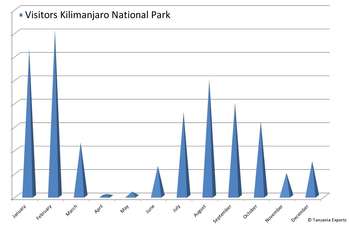
Kilimanjaro is only about 300 km south of the equator, so there are no European seasons. Instead, the mountain alternates between rainy and dry seasons. Since rain, mud, ice and snow place greater demands on the body when hiking, it is best to climb Kilimanjaro in the warmer and drier months. The best months for climbing are January and February. At this time it is warmer on the mountain, the sky is clear and the risk of rain is low. June, July and August are dry, but usually much colder.
January – March: Dry season, warm
April – May: Big rain season, cold
June – October: Dry season, very cold
November – December: Short rain season, cold
Approximate monthly distribution of Kilimanjaro National Park visitors per year
Mountain journal, by Rüdiger Achtenberg (Lemosho Route)
Day 1:
We are finally back in Africa! First we have to fill out the visa form and join the queue of the arrivals. Here we learn once again the meaning of the Pole-Pole! After we have finally paid the 50$ for the visa and could take our backpacks from the luggage conveyor belt, a large number of calling and holding up signs with names of locals is waiting for us at the exit. We do not appear anywhere! Is our driver not there yet? Most of the people who arrived with us have been picked up by now. We ask the few remaining locals, but they don’t have us on the list. Already a bit irritated we ask the last one and finally we find what we are looking for. He was supposed to pick up two people, but he could not remember the difficult names! Breathing a sigh of relief we get into the jeep, which takes us to Rivertrees Lodge next to the Usa River (near Arusha). A fantastically situated lodge (absolutely recommended!). In the afternoon our guide Godbless arrives and briefed us about the next 8 days.
Day 2:
Around 9.00am the team bus arrives. Our backpacks are quickly loaded and we both dive into the palaver of our team. Behind the small village of Boma N’Gombe we unfortunately leave the tarred road. Unfortunately, because the now following scree road is extremely bumpy and we repeatedly test the suspension of our seat up to the stop! Finally arrived at Londorossi Gate: The whole luggage is repacked into white, rainproof carrying bags with max. 20 kg weight each. On the scales the weight is checked very carefully and if necessary one or the other part has to be replaced. During the waiting time we get our packed lunch and register. Now the trekking should start, we think anyway. But all luggage is loaded again, we have to get into the team bus. Godbless tells us that we have to drive about ½ hour to the starting point. This trail is of an extreme nature! We have never seen such deep potholes before. Several times the driver stops, gets out, inspects the next meters and determines the snake course. Shortly before we reach our destination we don’t go any further, we are stuck! Everyone has to get out and push. With difficulty the bus struggles forward. The substructure crunches again and again over the ground. After a total of one ¾ hour the bus stops at the edge of a forest. Shaken through we get off. The luggage bags are distributed to the porters and we start with our day-pack on a forest road. Godbless and Assistant Guide Samehe lead us first past farmland, until after a good hour the trail narrows to a narrow trail. The rain forest begins. The path winds up narrowly and sometimes a tree stump must be overcome. At the edge of our resting place we discover a “garbage can” of a special kind: A round hole, a good 1 meter deep and 1 ½ meter wide was dug for it. One can only hope that it will be emptied regularly and not filled up at the end with its contents! After about 3 hours we reach our first camp: Big Tree Camp. Our tent is already pitched and a thermos with hot water and a big bowl of popcorn is waiting for us. Until dinner it takes another 2 hours, which we use to explore the small camp and take pictures. The night temperature here at 2.800 m is still bearable due to the forest location.
Day 3:
After the rich breakfast (porridge – for me enjoyable only with honey plus toast, tomato slices, mango and bananas) we start at 9.00 am again on the (dry!) rainforest trail. The vegetation is slowly getting lower, and we get more and more views of the hilly landscape. Sometimes a bit frustrating, because you can see the winding path already up to the horizon (kilometers away)! At the wayside we discover a termite burrow on a bush at a height of about 1.5 m. Looking at it closely takes revenge quickly, because some termites have probably tried to find a shorter way to their burrow by testing the variation over my shoes and calves, then probably finding the wrong way and biting their calves frustrated but very palpably! So it is much more relaxing to look at the different coloured straw flowers and the protea kilimanjarica which is in bloom right now! A porter with a very special head load passes our midday resting place: without any hand protection he carries two egg pallets on his head ! At the altitude of 3.800 m we see the kibo for the first time for a short moment. But the cloud curtain holds on very stubbornly until about 15.00 o’clock. We continue walking over undulating, stony heath landscape. Meanwhile the sun is shining very noticeably and the path seems endless. Far ahead we see a green tin round hut. This must be our camp! Only slowly it approaches us. Shortly before 4 p.m. a short steep ascent, and we have reached Shira Camp 2. This stage today demanded a good portion of perseverance. With 14 km it is the longest stage of the day, we climb about 1.000 meters of altitude. The thermos flask is quickly finished this time. We sit in front of the tent and see two porters passing us with two yellow water containers. They walk exactly our way back in search of a water place. We did not notice any watercourse, their way must be very long! After more than an hour they come back with the filled 20 kg containers on their heads. They and the porters in general are the real heroes at Kibo! The sun still offers us an impressive play of colours at Kibo. Meanwhile the clouds have almost disappeared. Around 5.30 pm we still see Kibo in a grey-brown colour, half an hour later it shines in a reddish colouring in front of a now almost blue sky. We enjoy this view, but already after ¼ hour the sun has disappeared behind Shira Cathedral and Kibo reappears in a grey colouring, influenced by the beginning twilight. In this camp we first feel the cold as soon as the sun disappears behind the horizon. After another delicious dinner and the following briefing about the course of tomorrow’s day by Godbless we prefer to crawl into our sleeping bags quickly.
Day 4:
Our waiter Joachim wakes us up at 6.30 am. The morning wash in the 5 cm high warm bowl water turns out spartan like every day. The breakfast with its abundant fruit quickly awakens our spirits and at 8.30 a.m. we start our next stage. It will lead us over 10 km to the Barranco Camp. On the now following routes up to the Barafu Hut we always have the Kibo in sight as a signpost and incentive. This changing view, first on the western flank, then, today and tomorrow, on the southern side, makes the Lemosho Route especially attractive. You won’t see that much Kibo on the other ascent routes! The amount of scree increases slowly, and after crossing a slight hill we can already see the unmistakable silhouette of the lava tower in the distance. At a fork in the path we also read the unmistakable sign on a stone: Lava Tower, Arrow Glacier, Barranco. Here we could have decided to take the direct route to Barranco Camp (the lower variant). During the pre-planning we consciously decided to take the “detour” via the Lava Tower, because due to the altitude (4.640 m) we can acclimatize better here, true to the already often mentioned principle: walk high – sleep low. Here at this signpost the Lemosho Route and the Machame Route coming from the right merge. For the first time we see the incision of the Western Breach on the opposite side of the Lava Tower. Seen from so far away, one does not recognize the degree of difficulty. The narrow path leads us down again through an approximately 5 m deep incision in the lava rock. Not good at all, as what we go downhill, we have to climb up again! Slightly meandering it goes purposefully towards the tower. It is now 12.00 o’clock. Just before the Lava Tower the porters have pitched the kitchen tent. After our arrival there, our lunch is already prepared, and for the first time we have the opportunity to have our meal directly at the foot of Kibo. The view fascinates us, somehow, the Kibo looks so harmless. Considering that we are only approximately 200 m underneath the Mont Blanc-height, this thought is soon put into perspective, specially also with the knowledge of the missing barely 1.300 m up to the Uhuru Peak! After lunch we take the opportunity to spend the rest of our break right at the foot of the Lava Tower. Afterwards the path leads us downhill again. To the left we see the first glacier tongues at Kibo. First Senecien appear at the edge of the path. Because of the non-dropping leaves they look very stocky with a pseudo-thick trunk. They develop sometimes very unusual shapes when they branch out. Giant lobelias (up to 1 m high) appear, and after a small hill we can see the day’s destination in front of us. The Barranco Camp is located very picturesquely behind a large collection of Senecias and directly at the foot of the imposing Barranco Wall. The many tents of different colours already pitched underline this impression. With popcorn, cookies and hot tea we let the afternoon come to an end at an altitude of about 4.000 m. The evening cold forces us very quickly into our sleeping bags after dinner.
Day 5:
With the start at 08.30 a.m. we are quickly faced with the first challenge of the day: Overcoming the Barranco Wall (a good 200 m high). Some groups have already started before us. They show us very clearly the course of the route due to the multicoloured clothing. The ascent is in a diagonal direction from the bottom left up the break-off edge. After ½ hour we have reached the foot of the BW. Now the ascent is very slow. Clients and Porter climb up densely crowded. At hardly any passage there is a possibility to pass. The slowest one sets the pace. Unfortunately, we have a group in front of us in which some members, at least it seems so, have a mountain stage ahead of them for the first time. Your guide has to partly specify exactly where the next foot step has to be placed, where the next hand grip has to be placed. Porter tries to get past this bottleneck, in vain. The 20 kg carrying weight does not exactly create a relaxed mood among them. After overcoming this bottleneck we continue to climb, we hardly need the walking sticks in this wall. After about 1 ½ hours we reach the plateau at an altitude of 4,200 m above the BW and enjoy the fantastic panoramic view of Mt. Meru, the Kibo and the nearby glaciers, 70 km away, during our well-deserved break. We are approached by water fetchers, i.e. the next camp seems not far away. The path leads us through the only barely overgrown landscape, the Kibo always on the left, until we see our day’s destination behind the next crest: Karanga Camp, 3,900 m high. It lies very unprotected at the foot of Kibo, but from here you have a magnificent view towards Uhuru Peak. We have booked this camp as an option to get better acclimatized in the now thinner air and the altitude around/above 4.000 m. We take our afternoon tea in front of the tent. In front of the silhouette of the Kibo we gather our whole team for a group picture. This shot will later be used as a basis for the distribution of the tip. Our team consists of the Guide Godbless, 1 Assistant Guide, 1 Cook, 1 Waiter and 5 Porters.
Day 6:
Due to the cold weather in the morning we have breakfast in the awning and enjoy the kibo view. The landscape changes, the vegetation has completely stopped in this alpine zone. Today’s ascent through the grey-brown colour of sand and scree will take us only 600 m up to Barafu Hut, our “base camp”. Already in the early afternoon we reach it. Compared to all previous camps it is the most uncomfortable. Because it is located on a slope in a scree field, the porters have to search very well to find a reasonably flat ground for the tents. The toilets are located on the upper part of the slope, so it is quite tedious to make your way through the impassable rock after dark from the tent a little further away. It is dry up here and we experience the nightmare of a camper: A mini-twister forms directly in the camp and tears a tent not far from ours from the ground fortification. The inhabitants are outside the tent and have to watch helplessly how their tent is torn away meters with the unpacked equipment. Fortunately almost everything is found again. Early crawl into our sleeping bags like tonight, firstly because it has become very cold outside and secondly to be able to sleep as much as possible (of course), because the last ascent is coming! The word “sleep” is to be seen here relatively, the deep sleep might have had only a small part, felt one rather dawns there in this height. Around 23.30 o’clock we are rudely awakened by many human voices around us. It is time for the midnight ascenders to leave. This palaver lasts almost an hour for our suffering.
Day 7:
At 5.00 a.m. we are woken up and after the minimalist breakfast (cookies and tea) we set off in the glow of our headlamps and in severe cold around 6 a.m. Just below the 5.000 m altitude we experience the sunrise behind the Mawenzi. With the now fast entering brightness the temperature rises noticeably. Under a cloudless sky we enjoy the impressive views “down” towards the saddle and Mawenzi as well as the view “up” on our ascent route. Our way winds in serpentines over solid lava rock and loose lava sand and we can use the breaks to take a deep breath, drink and eat energy bars. Again and again we stop to take pictures of the lava formations and valley views. Soon we meet some night climbers, most of them exhausted but happy (“I did it!”). The serpentines seem to have no end! Only when we see the first glacier formations on the upper left, we suspect that it will not be very long. Meanwhile it is 12 p.m. and after a last steep climb in the lava sand we reach the crater rim at Stella Point. Now we have officially climbed Kili, but we want to continue! After ½ hour we start to our last ascent destination. Along the left edge of the crater our way winds steadily higher with a moderate ascent. We now look at the huge glaciers at the outer crater. Especially the long Rebmann Glacier impresses us. The narrowing path leads us through low penitential snow formations and on dark lava sand. At 13.30 hrs we finally reach the summit sign shrunk to three boards: Uhuru Peak is reached! The thermometer shows + 170 degrees! Unbelievable, considering that the night climbers have experienced almost the temperature in minus degrees. For this reason alone our day ascent was worth it for us. Now we have a long break and the happiness hormones show their effect! After 45 minutes Godbless reminds us to leave for our last goal of the day: Descent into the crater. We continue walking along the crater rim and can already see the porter at the bottom of the crater. They have chosen the direct way from Stella Point to Crater Camp. Our descent is over a steep slope 200 m down. In the skating step we slide down the biggest part on our heels. This is very dusty, but we quickly lose some altitude meters. Finally arrived we let ourselves fall into our chairs slightly tired and somehow we don’t want to get up anymore. After 30 minutes Godbless comes up to us and asks if we want to go with him to the Reusch Crater. After a strong gulp from the drinking bottle and an energy bar he makes his way on the absolutely flat lava sand first to the Furtwängler Glacier. The glacier wall of the “little” Furtwängler extends (still) 10 m up into the bright blue sky. “Still” because we stood there again in July 2013 and were shocked to find out that these 10 m have melted down to less than half! The further way to the edge of the Reusch Crater leads us behind the Furtwängler ½ hour with a slight ascent up to the point that simply takes your breath away! One stands on the edge/round of the 800 m wide crater, as it could not be imagined more round. In this round, one looks at the throat of the crater. A unique moment for us to see this! A light plume of smoke rises 50 m below our point of view. It smells like sulphur. Godbless asks if there is still enough power to go to that point. Down goes easy, but up again at this altitude? But this opportunity will not come again! So yes! In the yellowish colored area of the smoke exit there are small, about 3 cm wide exit holes, the ground is lukewarm all around. If it would not smell so unpleasantly, one could stay here well! Take some more pictures and go back to the tents. The ascent goes very (!) pole-pole, always with breaks. But now richly exhausted we sink in the tent on the mattress and sink immediately into the sleep. Our Waiter wakes us up 1 ½ hours later to the “five o`clock tea”. We have rarely earned our tea-time like this! With the early sunset in the crater a very cold and uncomfortable night begins. Circling, partly strong winds beat against the tent walls again and again, so that we cannot sleep for a long time. Finally, this night is over after 10 hours in the sleeping bag. When I take the camera out of the photo bag, I see that the thermometer in the bag shows -50 degrees Celcius!
Day 8:
After breakfast (basis for the tea water are ice pieces from the glacier) we walk on flat lava sand towards Stella Point and in the already above mentioned skating step we arrive back at the Barafu Hut in less than 3 hours. Tea break, we continue on the Mweka route downhill. This long way down is extremely challenging for my toes despite the renewed binding of my shoes. In this night we finally sleep soundly again at 3.000 m altitude!
Day 9:
After breakfast we give the team the envelopes we prepared with the tip and the 9 team members sing the Kilimanjaro and Jambo song for us. The last descent to Mweka Gate is now again in the rainforest with the consequence that some passages are very slippery. Around noon we reach our destination and after the off-registration we know that very soon our now most ardent wish will come true: an extensive shower!


